Helping Poor People by Managing Flood and Erosion
Floods and erosion along the main rivers constrain Bangladesh’s economic growth and endanger the lives and livelihood of the people. ADB and the Netherlands are teaming up to support the government in providing a comprehensive, adaptive, and sustainable response to these challenges in Central Bangladesh.
Disasters Aggravate Poverty
Bangladesh occupies a major part of the world’s largest deltaic landscape, where two of the world’s largest rivers (Brahmaputra/Jamuna and Ganges) meet, forming the third-largest river in the world in terms of discharge. The country’s flat, low-lying topography is prone to disasters, with floodplains comprising about 80% of the country’s territory, out of which about 66% is less than 5 meters above mean sea level. Floods occur annually, with the regular flood (borsha) contributing to irrigation and the buildup of land and the high floods (bonno) causing devastation and loss of lives and livelihoods.
Riverbank erosion is difficult to predict and prevalent, particularly since the Great Assam Earthquake in 1950. The earthquake triggered a sediment wave slowly moving through the system over the past half-century. Its impact still influences the rivers today and has caused the Jamuna River to widen from about 8 to 12 kilometers (km) in Bangladesh, increasing the area occupied by the river from about 165 km² to about 240 km².
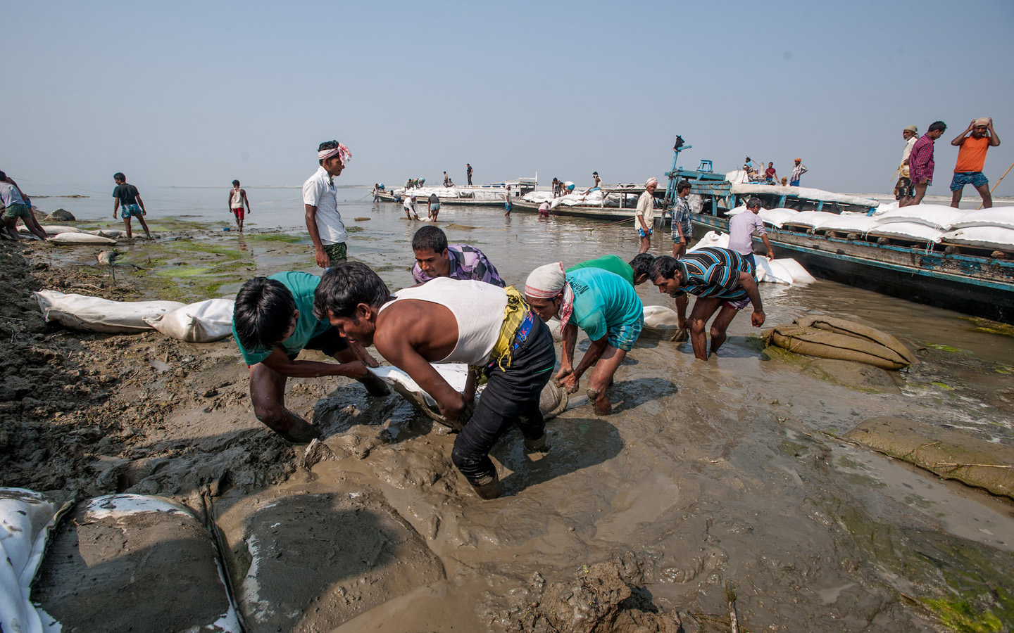
Due to riverbank erosion, the country annually lost about 5,000 to 6,000 hectares of land (the equivalent of a medium-sized irrigation project) between 1960 and 2000. Moreover, riverbank erosion displaces about 100,000 people every year. Many lose their home and agricultural land and are forced to move to urban slums. Floods also cause enormous damage and loss. During regular monsoon seasons, about 20% of the country is submerged. With heavier rainfalls, up to a third of the country can be inundated. Heavier monsoons, such as one generating a flood of a 100-year return period, are projected to inundate two-thirds of the country and are becoming more frequent. Large floods occurred recently in 2016, 2018, and 2020. Flooding damage farmlands and infrastructure, thereby decreasing productivity. Also, waterborne diseases and reduced hygiene levels during floods harm the population.
“Floods and erosion hamper economic growth in Bangladesh and force people into poverty. They especially affect poor people, who are often landless and dependent on agriculture,” said Olivier Drieu, senior water resources specialist, ADB. Rural poverty rates in the country reach as high as 85%. Without an effective and strategic response to these threats, more people will be pushed into poverty, especially from the riverine fringe areas, which are at the highest risk of erosion.
Interventions for Resilience
“The recurrent flooding and erosion in Bangladesh cannot be solved using a piecemeal approach,” Drieu said. Therefore, the Government of Bangladesh, ADB, and the Government of the Netherlands designed a holistic program to provide riverbank protection in critically eroding areas toward a more systematic stabilization of the rivers.
The government has approved the comprehensive, long-term Bangladesh Delta Plan 2100, in which the key planning principle is “adaptive delta management.” It targets a flexible approach and avoids rigid and costly “lock-in” situations when focusing too early on engineering solutions. ADB and the Government of the Netherlands are supporting the government in implementing this plan through the Flood and Riverbank Erosion Risk Management Investment Program (FRERMIP). This endeavor continues what the Jamuna-Meghna River Erosion Mitigation Project (JMREMP) began in 2003. The JMREMP developed an innovative, cost-effective, and adaptive riverbank protection approach that can effectively respond to the highly dynamic morphological changes of the main rivers.
The FRERMIP is implemented in successive tranches. The first tranche (2014–2021) constructed about 18 km of riverbank protection and 21 km of climate-resilient flood embankments, trained communities in disaster preparedness, and enhanced their awareness and resilience against flood and erosion risks in three priority areas along the Jamuna and Padma (combined flow of Jamuna and Ganges) rivers. The first tranche prepared a river stabilization plan (RSP) for the Jamuna and Padma rivers and their dependent areas, the North-central Zone with the capital city Dhaka. The RSP provides an indicative development plan for the Lower Jamuna and Upper Padma rivers for the next 10 years. It outlines strategies for decision-making and planning for these and for the other river reaches.
Under the second tranche (2022–2024), riverbank protection works will be extended based on the actual erosion and recent morphological developments. It is building infrastructure in the three priority sites, which includes an 8 km climate-resilient flood embankment and about 30 km of riverbank protection. Nature-based solutions are being integrated into the construction and upgrade of infrastructure; stand-alone solutions are also being tested.
The program is also fostering community involvement by building the capacity of at least 160 community disaster management units, training 40 existing disaster management units on disaster preparedness and emergency response, and forming at least 14 community groups for operation and maintenance and livelihood training programs. The second tranche of the program focuses on strengthening the stakeholders’ knowledge base and institutional capacity through training, publications, and study tours so the community can strategically manage the rivers.
To ensure streamlining of future investments and support the smooth implementation of the River Stabilization Plan and the Bangladesh Delta Plan 2100, the program’s second tranche also supports the expansion of the role of the river management chief engineer in the lead executing and implementing agency, the Bangladesh Water Development Board. All large-scale projects along the major rivers are expected to be planned and implemented under this office in the foreseeable future.
Benefits to Come
The benefits of this ongoing investment program provide important development impetus to riverine areas, which are disproportionately poor. The structural works (riverbank protection and embankments) will help minimize erosion and mitigate floods in central Bangladesh, enabling the poor to grow their livelihoods without fear of disaster. The works will reduce land loss and flood damage, increasing agricultural production. Estimates show that monsoon crop average yields will increase to 3.8 tons/hectare (ha) in 2028 with these structures, compared to 2.8 tons/ha in 2013. Average annual per capita income is also expected to increase from Tk74,380 per capita in 2012 to Tk136,000 in 2028.
Moreover, the interventions this program provides will help the country protect about 19,000 ha of land from inundation, when none was protected previously. It will also protect from erosion damage over 3,200 ha of land with existing assets. The program also aims to reclaim over 8,000 ha of land by stabilizing the riverbanks. Most importantly, these new structures will save lives. About 600,000 people will be protected by the infrastructure being built under this investment program.
Project Details
Bangladesh: Flood and Riverbank Erosion Risk Management Investment Program – Tranche 2
Cost
$212.8 million
- ADB Resources $157 million
- Government of Bangladesh $37.9 million
Cofinancing Partner
- Government of the Netherlands (Grant) $17.9 million
Dates
Approval Date 6 September 2021
Signing Date 1 March 2022
Completion Date 26 June 2024